This loop was Part 5 of 6 of my NCT/Lake Superior Adventure
Porcupine Mountains total distance: 52.2 miles
Cumulative NCT/Lake Superior Adventure distance: 615.9 miles
The Route:
Day 1: Begin at Presque Isle River and take Lake Superior Trail to Campsite LS site #1 (3.1 miles)
Day 2: Lake Superior Trail>Big Carp River Trail>Escarpment Trail>Government Peak Trail to Trap Falls (22.4 miles)
Day 3: Government Peak Trail>South Mirror Lake Trail>Summit Peak>Beaver Creek Trail>Little Carp River Trail>North Country Trail>Lake Superior Trail (26.7 miles)
Day 1: Presque Isle River to Lake Superior Campsite #1 (3.1 miles)
After taking a shuttle from Ely, Minnesota to Jay Cooke State Park near Duluth, I drove to Porcupine Mountains Wilderness State Park and parked at the backpackers' parking area near the Presque Isle River. After paying my overnight camping fees in the self register station, I began my short hike in the evening.
Part of the Lake Superior Trail is shared with the North Country National Scenic Trail.

I came to Manabezho Falls on the Presque Isle River.

Presque Isle River

There was a nice reflection and Lake Superior.

There was an interesting rocky crossing of a dry fork of the river.

The blazes were painted on the rock.


The Lake Superior Trail was mostly through the woods with some ups and downs over ridges.


The leaves were colorful!

The evening sun lit up the lake shore to the east.

It was a great campsite, one of the best on my NCT/ Lake Superior Adventure.

I had a great sunset over Lake Superior!


Day 2
Lake Superior Campsite #1 to Trap Falls (22.4 miles)
I awoke to colorful red leaves on the ground by my tent.

One thing that I noticed about the forests in the Porkies was that even though I was in the trees I could still see quite far and there was much less undergrowth than up north in Minnesota.

The trail went down to cross some creeks and was surprisingly steep at times.

I came to the Little Carp River.


I continued on the Lake Superior Trail. I planned to return to this spot after completing my loop.


I took a break on the lakeshore.


I came to the Big Carp River.

I joined the Big Carp Trail and followed it upstream.

Looking out to Lake Superior from the Big Carp River

There were some small waterfalls on the Big Carp River.


I continued through the forest. I passed two large groups heading the opposite direction and there was a fun river crossing on a log.

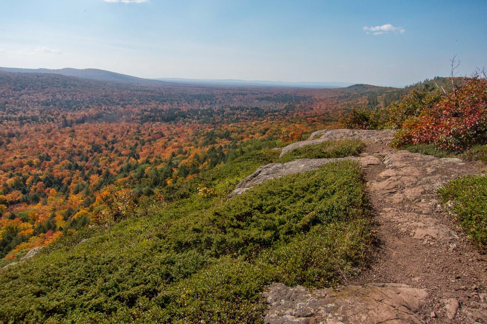
I climbed up to impressive views of the Big Carp Valley.


The views of the old growth forest's fall colors were some of the best I have seen!
Lake of the Clouds came into view in the distance.

The Porkies may have the rockiest and most rugged, cliff-like terrain in Michigan.


Lake of the Clouds


I came to the popular Lake of the Clouds Overlook. Notice the people on the top of the cliff.

The Big Carp River down far below.

The classic Lake of the Clouds overlook.

The Upper Carp above Lake of the Clouds

I looked down and discovered five leaves side by side, all different colors from red to green.

The Escarpment Trail was impressive as it paralleled the Upper Carp River down below.

Turning around revealed another view of Lake of the Clouds. This view was there almost the entire time I was on the Escarpment Trail.

The Upper Carp River


As I continued on the Escarpment Trail, Lake of the Clouds got farther and farther away.

As I neared the end of the Escarpment Trail, I came to a view of Lake Superior in the distance.

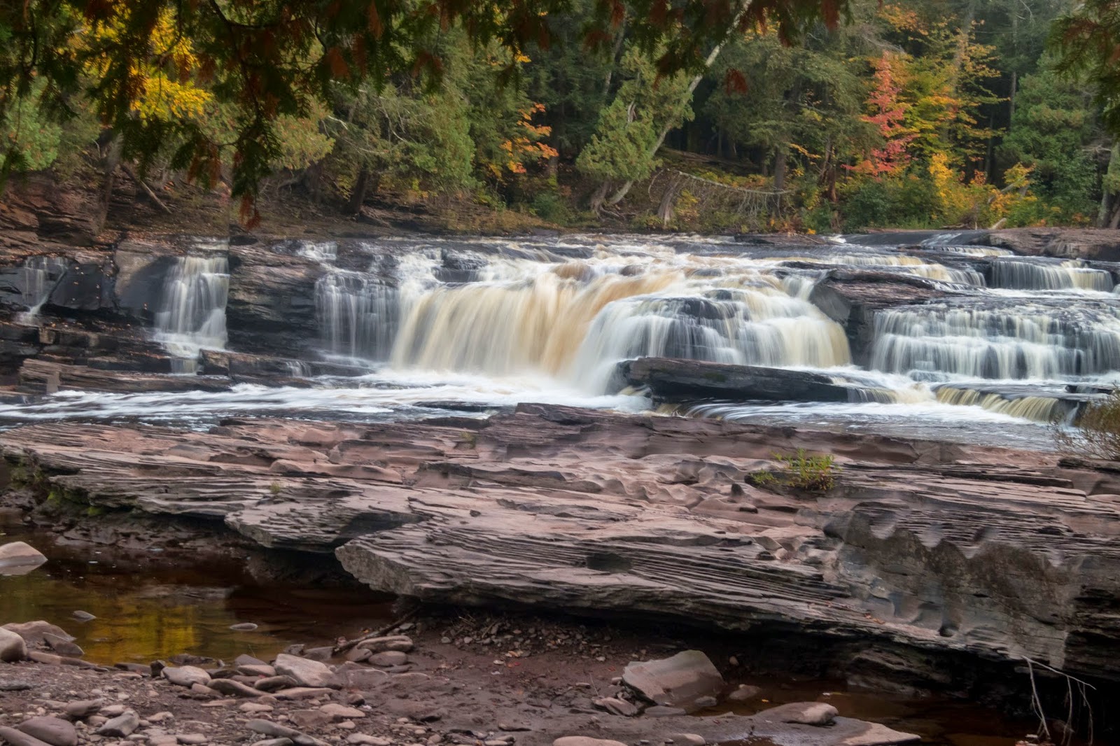
I joined the Government Peak Trail and crossed over the Upper Carp River. I came to Trap Falls and decided to set up camp. I crossed over the stream and set up camp the appropriate distance from the stream.
Trap Falls


Day 3
Trap Falls to Presque Isle River
Today was a long and exciting day! I began hiking in the beautiful forest. Leaves covered the forest floor.

I ascended to Government Peak which did not provide any views outside of the forest.

Lots of leaves were falling into the streams. I believe this is how a lot the rivers in this area get a "root beer" color.


I crunched my way through the leafy treaded trail.

I made it to the scenic Mirror Lake.

There was a nice reflection as I crossed the outlet stream.


I had a good climb to the top of Summit Peak. There is fantastic lookout tower that provides exceptional views. On a clear day Isle Royale, Part 1 of this exciting NCT/ Lake Superior Journey, is visible many miles away. My view was impressive but somewhat hazy as I could barely make out Lake Superior.


Looking down to the boardwalk below

I came to a second view point from a slightly lower vantage point.

Then I was back into the forest on my way to Lake Superior.

I hiked past Lily Pond on my way to join the North Country Trail on the Little Carp River.


Little Carp River


Trapper's Falls

The riverbank was quite steep in some places.

Near the Lake Superior Trail, I came to Trader's Falls.


After the meeting up with the Lake Superior Trail, my loop was complete. I began my backtrack to the Presque Isle River. I took a short break on the lakeshore by a big piece of driftwood.


I returned to the Lake Superior Trail for a pleasant evening hike back to the Presque Isle River. The sun was shining through the trees.

Back at the Presque Isle River

The bridge over the Presque Isle River


I continued farther upstream to Manido Falls.


I returned to my truck in the backpackers' parking lot and my adventure in Porcupine Mountains Wilderness State Park was complete.
The Porkies are definitely up there as far as hikes in Michigan. The number of people was quite a contrast to the solitude of the Boundary Waters, but the views here should not be missed, especially in the fall. There were still some mosquitoes here, but I'm sure they are far worse earlier in the season. The trails are well marked and maintained, although somewhat muddy in places. The Porkies have much to offer: scenic waterfalls and streams, old growth forest, pristine Lake Superior shoreline, and rocky ridges overlooking inland Lake of the Clouds.
One segment of my NCT/Lake Superior Adventure remained, Part 6: the Pictured Rocks Lakeshore Trail.
No comments:
Post a Comment