Bald Eagle Campsite to Silver Bay (24.6+22.7+23.9+22.6= 93.8)
SHT Miles to Date (49.6+93.8= 143.4)
Cumulative NCT/Lake Superior Adventure miles: 280.7
Highlights: Wolf Rock, trail magic, Gooseberry River and Falls, Breadloaf Ridge, Split Rock River, Lake Superior
The Superior Hiking Trail was Part 2 of 6 of my NCT/Lake Superior Adventure.
Campsites:
Big Bend on the west branch of Knife River
Silver Creek
Northwest Split Rock River
AmericInn Silver Bay
Day 3: Bald Eagle to Big Bend (24.6 miles)
From the Bald Eagle Campsite the trail rejoined the North Shore State Trail for some time.

After some trail by a series of ponds and along the Sucker River, I came to a unique beaver bond.

The Fox Farm campsite was marked by a friendly loon. I was surprised to arrive at the it so early in the afternoon because I had been looking at the mileage for Fox Farm Road which was farther down the trail.


Near Big Bend Campsite

Day 4: Big Bend to Silver Creek (22.7 miles)
The next morning the SHT was along many scenic ponds.


I climbed up to a maple forest and found the "12-Mile View" of Lake Superior 12 miles away.

I ran into my first backpacker while hiking the trail. He was hiking the opposite direction on a short trip. He is the maintainer of the McCarthy Creek campsite and had spent his first camping in his special site.
Grassy waterfall by McCarthy Creek

After entering the Lake County Demonstration Forest and passing the Drummond Grade, a former railroad grade, I came to Stewart River. While taking a break, I met my first thru-hiker. She was hiking Southbound and didn't seem to be having that great of a time. She stated that she really didn't like the trail that much and that it was nothing like what "they" said it was like. She spoke of the great dangers on the trail and told of having to leave the trail after extended rain. I tried to encourage her that the sections I had hiked were well marked and maintained with minimal elevation changes. I hope she finished her hike strong. I tried not to let her opinion of the trail and overall negativity discourage me, but at this point I was quite perplexed with how the trail was actually named the Superior Hiking Trail when it was so far from the lake. I appreciated the scenic beauty of the small streams, rivers, ponds, and forests but if the trail continued to be this way, I felt the name "Superior Hiking Trail" would not be appropriate.
Stewart River

After following Highway 2 for a short distance, I came to Dixie's Bar and Grill. I was craving some food so I ventured in. It was Sunday so there was football on and there was one other gentleman at the bar. He was quite talkative and interested in my hike and let me know about his past work experiences and some Lake Superior history. I ordered a large pizza. It was so good! I continued to talk to the friendly man. Eventually he departed and a few other couples arrived. I was still hungry so I couldn't pass up a brownie dessert. When I received my bill, I was confused. It only on had the brownie dessert on it. I was told the guy I had been talking to had bought my pizza without me even knowing it! Thank you kind Sir. You are a true trail angel!
Back on the trail I was quite inspired by the trail magic. I continued to the Silver Creek Campsite where I met southbound thru-hiker, Paul. He was starting to build a fire. It was his first thru-hike and he was having a great time. He reassured me that he had experienced no such "dangers" as I had heard earlier in the day and that the trail was quite spectacular with numerous views and raging rivers to come. I let him know about how much I enjoyed the Duluth section and he was thinking about continuing past Martin Road. We discussed our plans for future adventures around the US.
Day 5: Silver Creek to Northwest Split Rock River (23.5+.4 =23.9)
Silver Creek

From Silver Creek it was a short distance to Lake County Road 301 and from there, another two miles to some of the best views I had seen in days starting with the Pine Ridge Overlook.


A rock bridge had been built over the Encampment River after keeping bridge intact had been challenging. The ridge down to the river was quite steep and the trail was designed very well.

From the Castle Danger Trailhead it was a short hike to spectacular ridgeline views of Lake Superior from Wolf Rock.


I took the short spur trail to the Crow Creek Valley Overlook where I met a large group of hikers who were learning about Leave No Trace.

There were great views to the north and east from Mike's Rock.

Soon I reached the Gooseberry River and some beaver activity.

The SHT crosses the Gooseberry River on the Fifth Falls Bridge the biggest falls I'd seen since Jay Cooke State Park.

The trail continued downstream and I took a short side trip to see if I could find some water at the visitor center. I didn't find any, but seeing more waterfalls surprised me because the guidebook didn't say much about them. They were well worth the visit!
Upper Gooseberry Falls

Middle Gooseberry Falls


Upper Falls

Back on the main SHT, I climbed up to the best views of Lake Superior yet on Breadloaf Ridge.


The trail then enters Split Rock Lighthouse State Park and travels north along the Split Rock River past rhylolite canyons and rock formations.


I began looking for an available campsite as I hiked along the river. I could see on the other side that the southeast campsite was beautiful but already had multiple tents.

There was a large group in the Southwest campsite. The Northwest site was empty but I decided to check out the Northeast site. It was was up quite high on the ridge so I returned to the Northwest site to camp for the night. It was located near the bridge in a scenic location.


Day 6: Northwest Split Rock River to Silver Bay (1.9+.7+3+14.3+2.7=22.6)
In the morning the sun lit up the rocks. It was the day I planned to reach Silver Bay for my first resupply.


I came to an outstanding overlook of Lake Superior.


I took a side trip down to the lake shore via the spur trail to the Split Rock River Wayside. The lake was so close and I couldn't pass up the opportunity, considering I could hike some in the park and return to the SHT on a different spur trail.
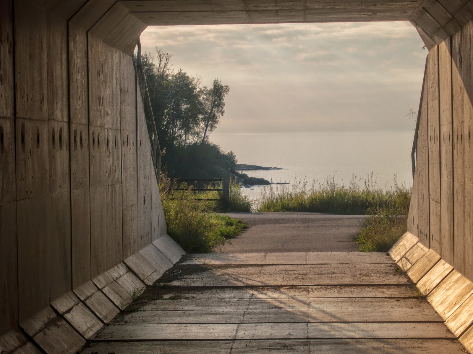
The box culvert under Highway 61
Mouth of the Split Rock River


I hiked past the state park backpacking sites. Only one was occupied. They are very scenic, but do require a fee.

I climbed to the top of Day Hill for awesome views of the lake and the Split Rock Lighthouse.


Split Rock Lighthouse

I joined the spur trail and returned to the main SHT. There was excellent hiking on rocky ridges.

The section to Beaver Bay passed Christmas Tree and Fault Line Ridges. I experienced some of the best inland views yet.


There were views of Lake Superior as well!

And a pond down below!


The trail finally descended and followed the shore of the Beaver River and then crossed railroad tracks. I heard trains passing by and they were quite loud, something to consider if thinking of choosing to camp nearby. I had cell service by the river so I called the AmericInn in Silver Bay to arrange for a room for the night.
Beaver River

The trail then ascended to even more ridgeline views.

Only to descend and then ascend again! The trail was quite rocky.

Thinking back, my mind must have been distracted by thoughts of pizza and a shower to fully appreciate these views. They are quite special.


After feeling like I had been walking in circles the trail finally descended to Penn Blvd. and I hiked into and through town to the AmericInn which is located all by itself off Highway 61. I ordered the family deal special with a 16" pizza, breadsticks, and cinnamon treats from Jimmy's Pizza, the only place in town that delivers. I ate half the food and saved half of it for the trail.
 Continue to Silver Bay to Grand Marais
There is some land for sale between Beaver River and Penn Blvd. with the Superior Hiking Trail just north of the land close to Penn Blvd. Do you recall this area specifically? You did comment "Thinking back, my mind must have been distracted by thoughts of pizza and a shower to fully appreciate these views. They are quite special." But then just before descending to Penn Blvd you said "After feeling like I had been walking in circles the trail finally descended to PennBlvd." If you can recall this hike and reply that would be great. My email is kempl333@yahoo.com
ReplyDeleteI also meant to say that my husband and I love that area, we have hiked to Bean and Bear Lakes twice and find it so beautiful. We love to hike and it would seem an ideal place to be but wonder if you had any particular thoughts or recollections. We are looking for a cabin site up in that area to be closer to BWCAW as we canoe/camp also. Thanks for posting the BEAUTIFUL pictures!!!
ReplyDelete