~ 45 unique NCT miles
Of all the national scenic trails, I have currently hiked the most miles on the North Country Trail, a 4600 mile
trail from North Dakota to New York (soon Vermont). Whether it be beautiful segments in the Boundary Waters Canoe Area Wilderness (Border Route Trail, Kekekabic Trail), along Lake Superior's beautiful shoreline (Superior Hiking Trail, Pictured Rocks National Lakeshore), or in Michigan's Lower Peninsula (Manistee River, Jordan River Pathway), the NCT has provided exceptional backpacking opportunities.
In the summer of 2016 I have returned to Northern Lower Michigan and have had the opportunity to complete much of the established NCT in the eastern upper peninsula. This section includes remote country in the Hiawatha National Forest and along the beautiful shore of Lake Superior. I have also been able to arrange for 3-day weekends at work and plan to use my bike more frequently vs. backtracking on the NCT as I have previously done.
During the weekend of May 13-16, 2016, I was able to complete a fantastic hike on the NCT from Straits State Park through St. Ignace and in the Hiawatha National Forest to Trout Brook Pond. I hiked a scenic backtrack to the rail trail near M-123 and biked back to St. Ignace.
See map below:
This was an exceptional hike with many highlights including Bridge View, the scenic St. Ignace boardwalk, Brevort River and Lake, the Carp River, trillium, Guard Lake, the Niagara Escarpment, and much more.
I started at a parking area in St. Ignace near the Wawatum Lighthouse after I had previously dropped my bike off at M-123 the night before and slept in my vehicle at the trailhead.
It was a great morning view.


I hiked over to Straits State Park using mainly sidewalk and a quick road walk.


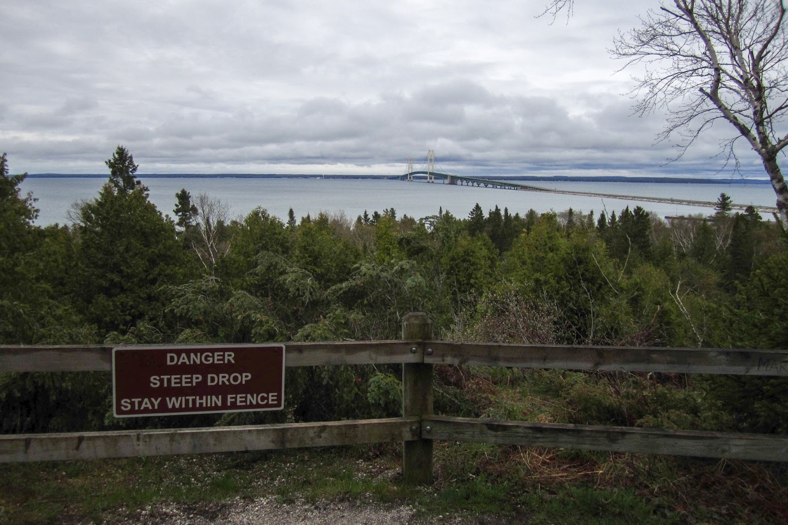
Soon I came to the impressive Bridge View of the Mackinac Bridge.


After descending the stairs, I was quickly at the trailhead at the Michigan Welcome Center.


I turned around and started hiking back to St. Ignace. There were some impressive rocks near the trail.

Back at the Bridge View, I enjoyed the view once again.

A short distance away from the view on the trail, I found an even more expansive view of the bridge.

I was back in St. Ignace. It was a pleasant morning, but chilly.


The NCT follows along the edge of Lake Huron on the scenic boardwalk. This is the only section of NCT on Lake Huron.

There were informative signs about hikes on the NCT.


The classic Mackinaw Boat.


I could see the ferries heading over to Mackinac Island.

Soon my hike through town was complete and I made my way to an old rail grade that the NCT uses on its way to the Castle Rock Trailhead. This is the same rail trail that I would use on my return when biking.

The trail goes under I-75.

It was a scenic trail that was initially parallel to a road but it was hard to tell with thick trees nearby. I saw a couple people out walking in the morning.


As I crossed Cheeseman Road. There was a sign for the North Country Trail.

The rail trail did provide some expansive views.


Soon I arrived at the Castle Rock Trailhead. There was a car parked there as well and I thought someone might be out for an early morning hike.

Soon I met Dennis, President of the NCTA Hiawatha Shore-to-Shore. He was awaiting the arrival of nearly 30 hikers for a special annual hike. He told me about the trail conditions and scenic sections. He also provided some delicious trail magic with a brownie! Thanks Dennis!

I continued on the trail with the possibility of seeing the group as they were planning to hike the opposite direction.

The trail was in excellent condition and it was a beautiful day.


I went through a few swampy areas.


There was a nice view at a scenic pond.

It was a pleasant hike through the forest.


The trail went up on a ridge and as it turned, there was a great view through the trees. I stopped for a break.

The trail climbed up on some old dunes.

There were more distant views.


I stopped for a break at a bench and it took some time for me to realize that I could barely see the Mackinac Bridge in the distance.


Soon I met those out hiking with the NCTA. They were hiking in three groups. Dennis was in the second group and we stopped to talk for a little. Then I met Tom, the chapter's vice president with the last group. They stopped to take a picture.

At the Pte. Auxchene River there was an interesting skull on the sign.

Bridge over the Pte. Auxchene River


Another well-constructed board walk


As I neared the Brevort River there was a helpful sign indicating mileage. The signage through this section of trail is excellent.

I was quickly at the bridge over the Brevort River.

Brevort River


The Brevort River was one of my highlights for the day as the trail stayed close to its banks.


The trail crossed the Brevort River on the road.


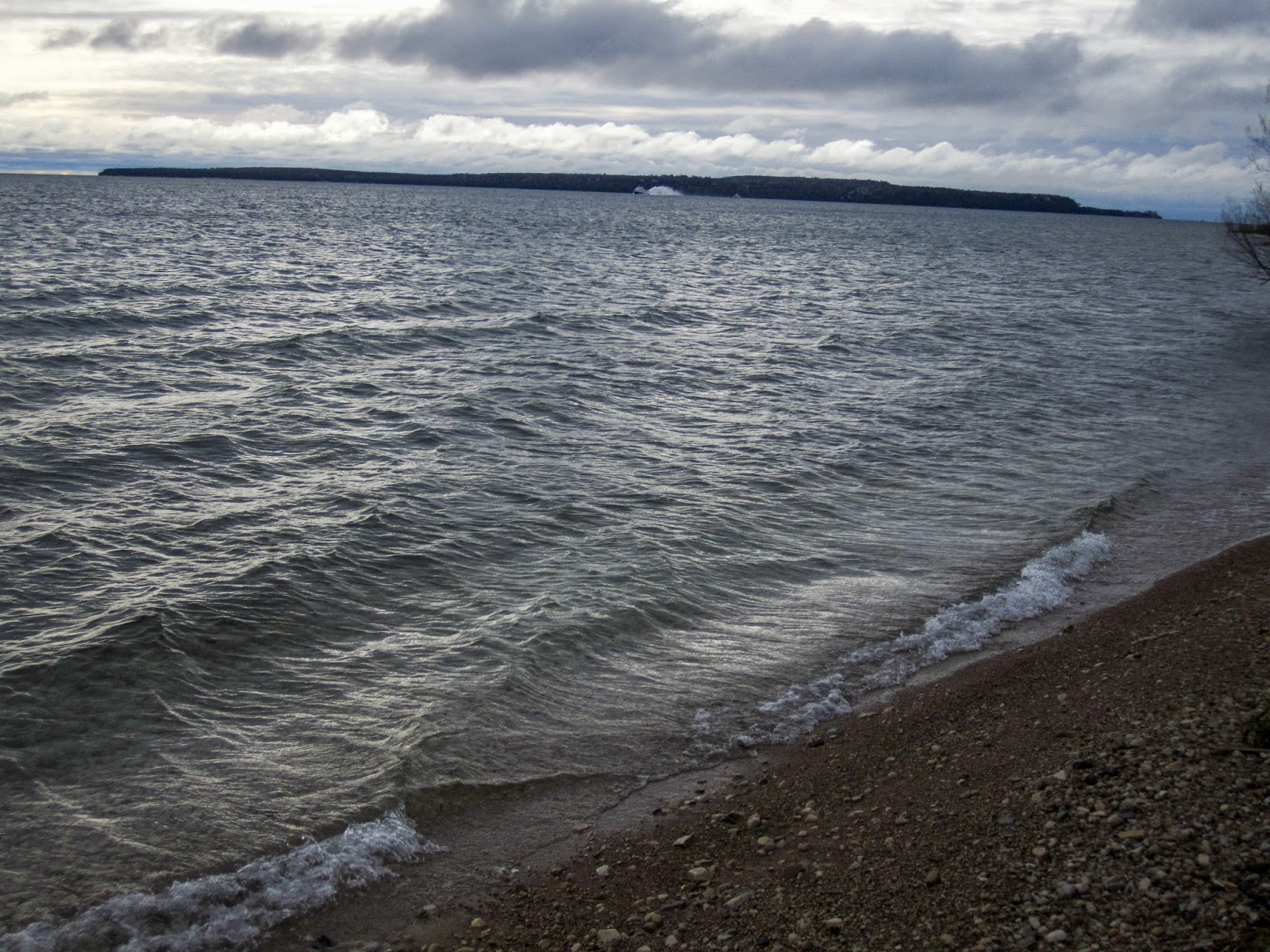
I was able to get my first view of Brevort Lake through the trees.


Brevort Lake is quite large. I walked out to a point near the dam that provided an expansive view.


Then I descended to the dam. There was a beautiful place to camp nearby. I considered camping here, but decided otherwise as it was still early in the day and I anticipated a cold night near the lake.

Brevort Lake


Brevort Lake Dam


I stopped for a break and to get some water.


I climbed up on the ridge nearby for a view of the dam from above.

Then I was back on the trail.

I decided it would be a long day, but I could probably make it to the Carp River where there was supposed to be backcountry camping.

I crossed the road near the Brevort Lake Campground and decided to continue on the NCT as I didn't have much time to spare. Many trailheads have helpful maps with written descriptions of the trail.


I crossed the Little Brevort River on the road.


It was getting into the evening and I was starting to get tired, but I was getting close to the Carp River.


The trail crossed I believe Silver Creek.


Later I came to another scenic pond.

The pleasant hiking continued.

I crossed a gas pipeline.

There was an area where the trail was flooded but it was easy to get around.

I made it to the Carp River and began looking for a place to camp. There was a fire ring on the South side of the river. It didn't look that great though.

I decided to cross over the bridge.

I found a great spot on the other side to set up camp.

the impressive bridge over the Carp River
Campsite on the Carp River


I slept well and woke up early with plans to camp at Guard Lake, but to leave my gear and hike out as far as time permitted and backtrack. Near the Carp River there was another excellent section of boardwalk.


Soon I came out to M-123.

There was a creative NCT sign on the other side.

I hiked past my bike that I had stashed in the woods and followed the NCT on the rail trail for a short distance.

I entered the forest again and hiked a section that had a fair amount of blowdowns.


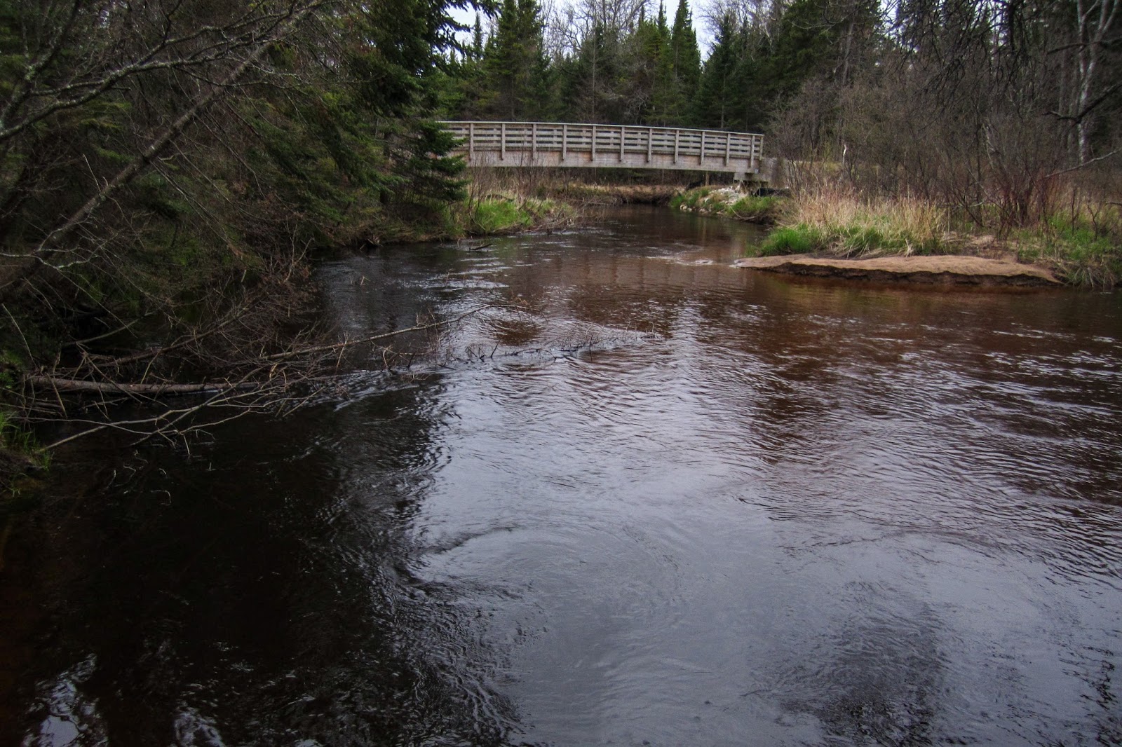
It wasn't long before I arrived at Taylor Creek.


Taylor Creek


I continued on excellent boardwalk.

There was some marsh marigolds near the trail.

I could see how the area was changing with more rocks and trees growing from rocks.

I found my first trillium of the hike.

The trail traveled through swampy areas where it has been raised.

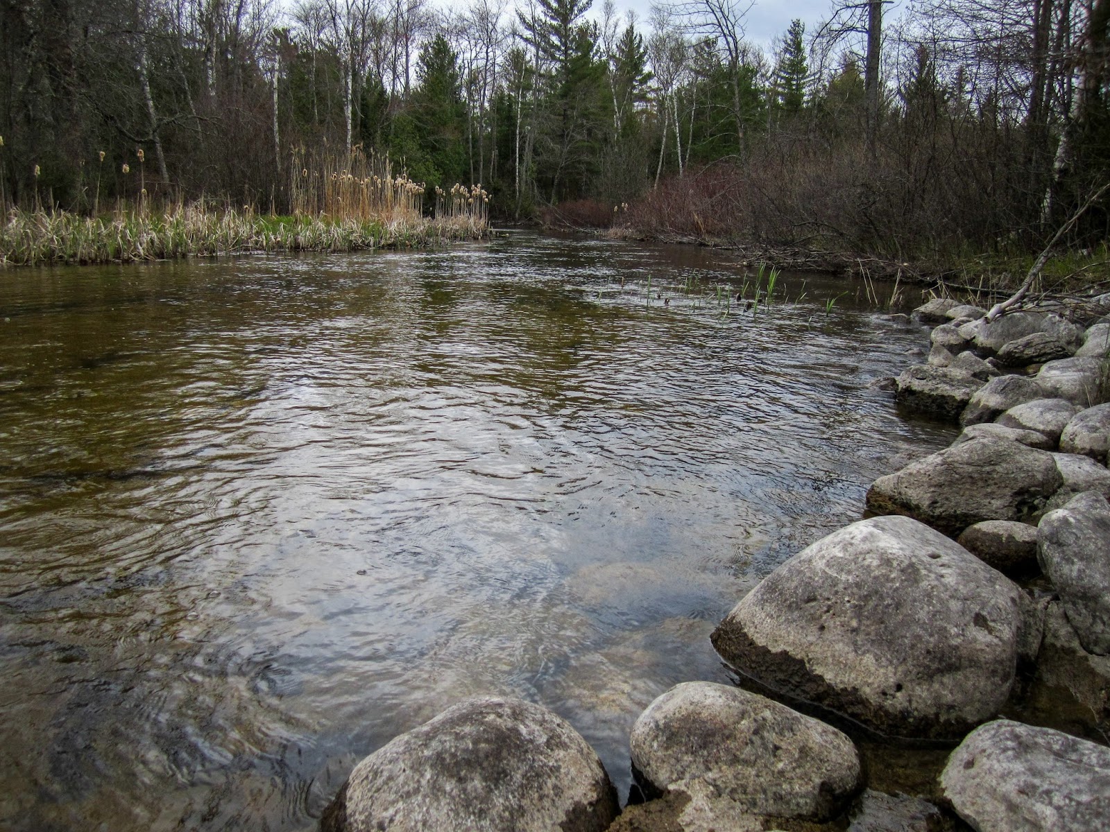
I came to the North Branch of the Carp River.

I followed a trail along the edge of the river but soon I figured out it wasn't the NCT. There were good camping opportunities nearby.


I found a scenic view of the river.

There was an interesting large rock in the water.


I found a large tree growing out of a rock.


Then I found lots of trilliums.

Then it started to snow.


It was white out but the snow didn't seem to stick.


Some snow landed on the trilliums.


I even found a pink trillium.


Many of the road crossings in this area were simply forest roads with little traffic.

I came to the trailhead at East Lake Road.


Then I came to Guard Lake.

I passed a pond near the lake with a nice reflection.

The trail near the lake was wet and I looked for a place to set up camp later.

After passing Guard Lake I took a break and then dropped my pack and began a day hike. Looking at my map I decided I could probably make it to Trout Brook Pond before I would need to turn around.

The terrain began to change as I neared the Niagara Escarpment. I wasn't quite sure what to expect but I was excited.

The trail went right through a logging area.


Soon I was at the escarpment which was very impressive. Near the trail I even found an arch.


I walked under the arch and then climbed up to the top of the escarpment for a different view.


I found a way down from the escarpment and continued on the NCT.

The trail went right past an overhanging portion of the escarpment.


The trail left the escarpment and soon reached a nearby road.

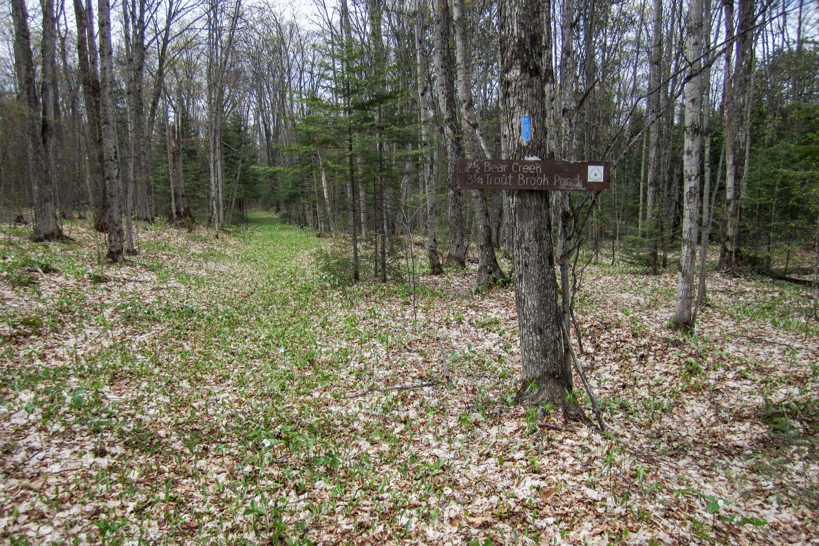
I was 3.25 miles from Trout Brook Pond.
I followed the trail which crossed the road, followed some new boardwalk and then crossed the road again.

I crossed Little Bear Creek on the road.

I came to a pond that was visible through the trees.

It was a nice view, but I was somewhat confused as the trail seemed different than my 50 Hikes on Michigan & Wisconsin's North Country Trail describes.

I came to a side trail that brought a view of an impressive beaver dam.


The trail then crossed a small creek, but I was unsure what it was.


Then I came to what I thought was Bear Creek.

I climbed up a ridge and then hiked through some pines.

Soon I reached a trailhead that indicated I had been on a re-routed portion of trail.

It was a quick walk over for a scenic view of Trout Brook Pond.

There was even an island. I looked around and decided Trout Brook Pond would be a great place to camp in the future.


Panorama of Trout Brook Pond

On the way back I decided to explore a different route on the way back to Guard Lake. I ran back to Bear Creek and then found some blue ribbons tied to trees. They said NCT on them so I followed for little while, then decided they were going in the wrong direction. Back on the NCT I came to a turn and noticed an orange blaze nearby. I decided to investigate and found that it was actually an old blue blaze that had been painted over, similar to the blazes on the Fife Lake Loop. I decided to follow the blazes and see what I would find.

I came to an area that was flooded, but made it across reasonably dry.

The trail was easy to follow and soon was back to being blue blazed.

I came to a massive beaver dam and remembered the trail description from on the trailhead signs that I had read.

I crossed the beaver dam and discovered that the center of it had collapsed. I was able to descend off it and make my way around to the other side to the portion that was still intact.


I followed the blazes on the other side and then took a side trip to get a better view of the dam. I found a board walk that looked like it was previously under water.

Looking back to the massive beaver dam on Little Bear Creek

The trail stayed close to the water with great views.

On the western end the pond had dried up.

I followed some old boardwalk and was careful where I stepped.


Soon I came out to the NCT. Pictured below shows the NCT to the left and the old route to the right. I have since discovered that the old route was condemned due to the beaver dam and that the old boardwalk south of the dam will soon be removed. It makes a scenic loop, but hike at your own risk as the old route is not official anymore.

The junction is shortly after the rock with the blue blaze.

Soon I was back at the escarpment.

I thought I found another arch but it was a tree that had fallen.


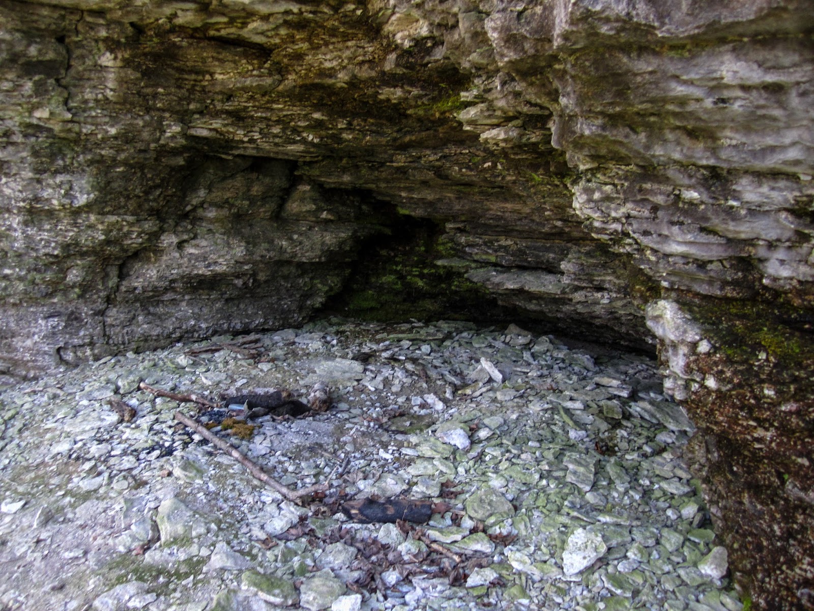
I found a little cave-like space that was interesting.


I left the trail and continued to follow the escarpment on the nearby ridge.

Soon I reached the end of the escarpment and I reconnected with the NCT that was nearby.

I walked past the "tool crib" near the logging area.


I had a great rest of the hike on the way back to Guard Lake with many trillium.


There was a fairly large widow-maker hanging from high above.


Soon I reached my pack and was at Guard Lake.

I set up camp at an obvious place that had had a fire before near the lake.

I ate some food and enjoyed a relaxing evening.

The evening light lit up the trees across the lake.


Looking at the sunset through the trees


After sunset the sky turned pink.

As I was getting ready to go to sleep, I heard a vehicle pull up. I hoped it wasn't a bunch of partiers out for the night. Soon a small dog came to say "Hi" in front of my tent. A couple walked by on an evening stroll.
I had a restful night and awoke to light rain and cloudy skies.

I began my back track to M-123 to my bike on the rail trail.

The trillium were all over the place.

In some places the trail was quite rocky.

I could just barely see the Taylor Creek Bridge through the trees.

Taylor Creek

From Taylor Creek I experienced the most blow downs of the hike, some quite significant. Most didn't take long to get around, but overall there were probably 50+ in a 4 mile section.
Soon I was at the rail trail.

I retrieved my bike from the woods and started heading back to St. Ignace.

I stopped at the Carp River to get some water.

Bridge over the Carp River


At a road crossing I saw a sign for the Mackinac Wilderness.


The rail trail did provide some nice scenery with a nice lake in an area away from a road.


I came to the Castle Rock Trailhead and took a break.

Then I continued on the portion of rail trail that I had previously hiked.

I crossed under I-75 again and decided to stash my bike so I could hike the portion through St. Ignace again.


Soon I was back at Lake Huron and this time there were bugs everywhere. They didn't bite, but it was hard to breath. The views were excellent!

another informative sign about the NCT


I was surprised to see the Isle Royale Queen III nearby, but apparently it hasn't been providing service to Isle Royale since 2004.


I was almost back to where I parked near the lighthouse. I decided to walk up to the lighthouse for a better view.


From the lighthouse it was a quick walk back to my vehicle. After driving back to pick up my bike, the weekend's adventure was complete.
Overall, this was an exceptional section of the NCT, one of my favorites. Once away from St. Ignace, the feeling of remoteness was much greater than on the NCT in the lower peninsula. Many thanks to those who have helped maintain this fine section of trail. I look forward to completing many more hikes on NCT in the upper peninsula this summer!
Eric - This is the best photo-essay! Substantial work has been done, AFTER your hike, to clear and maintain the trail sections that you captured. Thank you for doing such a great job.
ReplyDeleteThank YOU for all the hard work on the trail!
DeleteThis comment has been removed by the author.
ReplyDeleteThe documentation of your NCT experience in the Eastern UP is fascinating; thanks for taking the time to produce this excellent work that focuses on my environs. Furthermore, and most importantly, props to you for implicitly witnessing to our great Lord and Savior Jesus Christ [sentence in the "About Me" cell of your blog post]
ReplyDelete