Distance: 37.9 km (23.55 miles)
Paths: Island Meadow (10.1), Bear Cove Point (11.6), Spurwink Island (4.5/17.1)
Communities (road walks): Cappahayden (0.0); Renews (4.7); Kingman's Cove, Fermeuse, and Port Kirwan (7.0)
My first day on the East Coast Trail began at ~10 am after my parents gave me a ride from St. John's. It was nice to see many of the communities that I would walk through on the drive.
Finding the trailhead was fairly simple as I used a gps track from thru-hiker Randy Best. There were two signs at the trailhead: one for the Island Meadow Path and another for distance to communities all the way to Fort Amherst near St. Johns. Those was not a sign indicating the entire distance of the East Coast Trail at this time.
Southern Terminus of ECT at Cappahayden

I convinced my dad to join me for the first few kilometers to Bear Cove. It was a cloudy day but good hiking weather. As we started on the trail, a truck drove past us going the other way. I wondered if the trail was actually someone's driveway.

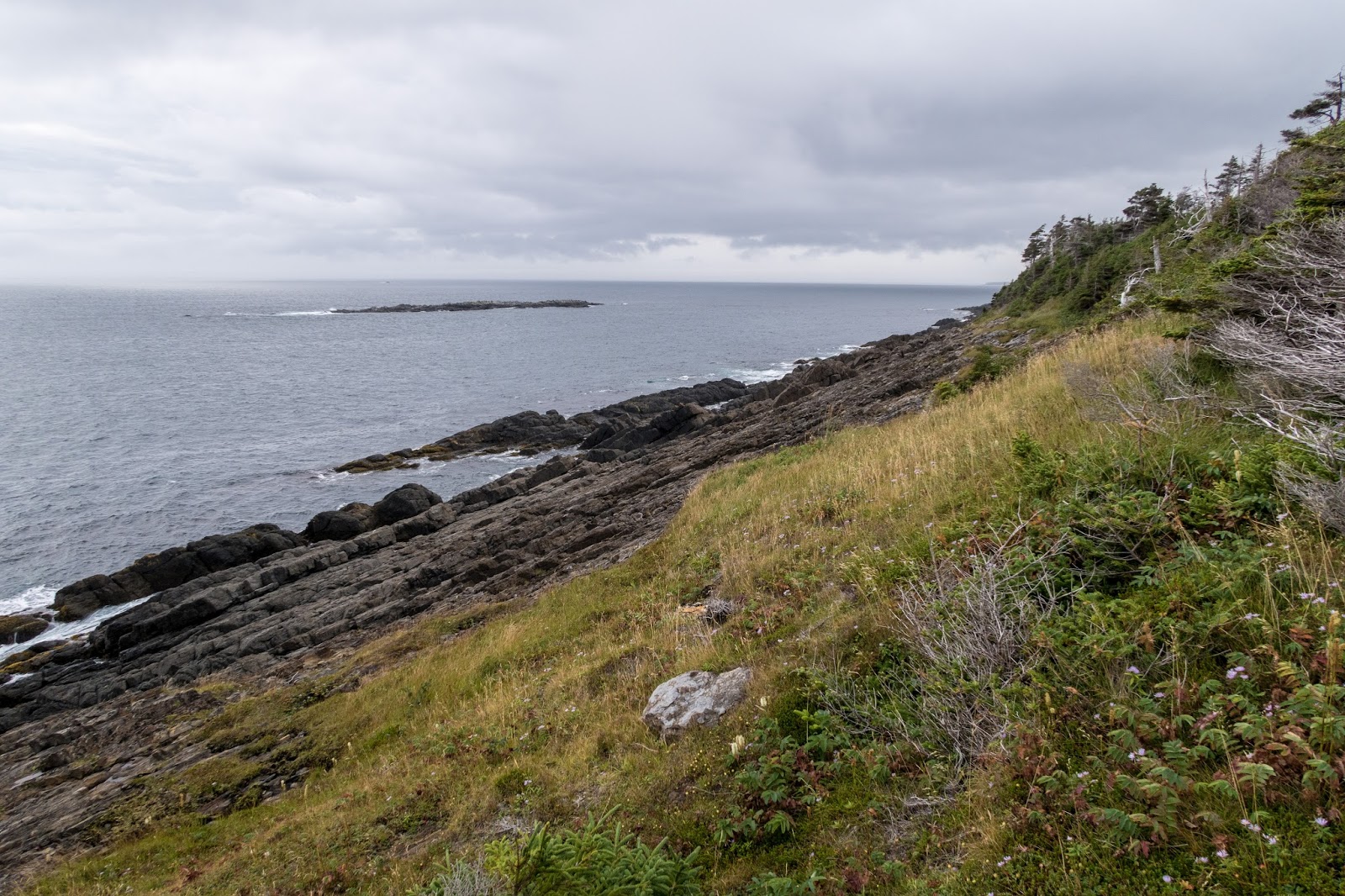
It was a scenic start to the hike. The trail stayed near the coast through grassy trail.


There were many nice flowers near the trail.

The trail initially was near some houses, but stayed close to the water.

Looking back to Cappahayden


The view south

It was a fairly calm day.


My dad was really enjoying the trail and was impressed with the high quality trail.


The trail did go past a cutting area.

Then some pleasant forest hiking.


There were many berries beside the trail which would be a constant temptation throughout the entire East Coast Trail.


Back in the forest, there was some excellent trail construction. This easy walking was quite the contrast to the remote hiking I had just completed the week before in western Newfoundland on the IAT UltramaTrex.


Soon we reached Bear Cove and my mom was waiting to pick us up.

My parents were staying in Newfoundland for several more days, but this would be the last day that I saw them. My mom gave me an apple. It had been nearly the perfect family vacation as I had been able to hike much of the IAT UltramaTrex with my brother and lots of sightseeing with all of us. I'm also very appreciative for all the help my parents provided with transportation and food.

From Bear Cove, I set off solo for Portugal Cove, ~300+ km away.


The trail went through a thick forest.


One of the common trail markers on the ECT, the white triangle.


I reached Island Meadow and a view of Renews Island.


Renews Island


There was some pretty dramatic scenery.

The entire ECT passes so many viewpoints. Many of them are named, but with just a map it would be very challenging to know which one I was at. The East Coast Trail Association has done an excellent job with signage for these locations. Many of the signs are very artistic.

Peter Powers Cove


There was a nice view across Renews Harbour from Gripes Nest Hill. I could see a small fishing boat down below.

There was a side rail to a view point. There are many side trails on the ECT. I determined if all the work had been done to make these trails, I should do my best to hike as many as I could.


Looking to Renews


I could see across the harbor to the southern end of the Bear Cove Point Path and the Mount.


I reached the end of my first of 26 paths on the ECT.

I began the "Community Link" through Renews. These road walks on the ECT are rarely marked, but relatively easy to follow. There are times, however, when I had trouble determining whether someone's driveway was the road or not. If I ever had a doubt, I looked at the GPS track on my phone and didn't have any issues finding trailheads.

Renews Harbour

Part of the link was along the highway, but there was a nice shoulder and not many cars. I noticed that traveling northbound on the ECT would mean that I would often need to have the road between me and the water if I wanted to walk on the opposite side of the road for safety.

Somewhere along this road walk, I experienced what may have been one of the hardest challenges of the entire hike. A vehicle pulled up beside me and a friendly Newfoundlander offered me a ride to the nearest trailhead. I felt bad to have to turn him down, but stated I was hiking the whole trail.


I was surprised to see a sign beside the road indicating the Mayflower Landing Site in 1620. Per wikipedia, "Recent research has revealed that the ship called in at the tiny fishing village of Renews in Newfoundland for fresh water and food, before finally anchoring off, what is now Provincetown." I don't see a citation though.

I reached the second path on the ECT, the Bear Cove Point Path.

Near the trailhead I explored the Mount.

The Mount is the site of an 18th century gun battery.


Looking back to Renews

The Mount


I reached the edge of the harbour and headed back out on the coast.


Looking back to Gripes Head Hill on the Island Meadow Trail

There was some forested trail, which was muddy at times.


I went past some dramatic scenery on the way to Southern Cove.


I could hear the foghorn from the Bear Cove Light.

Southern Cove

Just before the road by the Bear Cove Light, I found an unofficial campsite beside the trail.


Bear Cove Light

I took a side trail to see Bear Cove Point. This is the half-way point of this path.

Bear Cove Point


I could see across Fermeuse Harbour to North Head.


I followed an old cart track to the end of the Bear Cove Point Path.


The next community link includes Kingman's Cove, Fermeuse, and Port Kirwin. At 7.0 km it is the second longest after the link through St. Johns.


Port Kirwin

I reached the Spurwink Island Path a little after 7 pm. My spreadsheet indicated a great campsite near Chance Pond River 4.5 km away so I hustled to make it there. At 17.1 km, the path is one of the longest on the ECT. It is also connects with the Mudder Wet Path for a continuous stretch of 20 km without a road walk.


It was quickly getting dark and I could tell the days were getting shorter.


There were some great views.


Soon it was dark and I continued hiking with my head lamp. I stopped for a photo with a long exposure using my mini tripod as I could see lights in the distance, probably from Ferryland.

I reached the Chance Pond River and set up camp on the north side. It was a rainy night, but I slept well.
Continue to Day 2
Thank you, Eric, for your comments. I notice that the sun is not a part of the trail. Hum!
ReplyDeletePierre-Émile.
I love these images and want to see this kind of stunning views persoanlly, because it attract me always and try to ejoy it during my east coast trip.
ReplyDelete