Distance: 34.5 km (21.44 miles). Cumulative: 72.4 km
Paths: Spurwink Island (12.6/17.1), Mudder Wet (2.9), Sounding Hills (5.5), Caplin Bay (5.2)
Communities: Aquaforte (3.0), Ferryland (0.9), Calvert (4.4)
I awoke to a cloudy and foggy morning, but it wasn't raining. I got my first view of Chance Bay.

Chance Pond River

There was some beautiful forested trail.


I reached Berry Head Arch, one of the most impressive spots on the entire ECT.


On top of Berry Head Arch


I came to the Spurwink Island Viewpoint, but all I could see were clouds.

I went past the Gallows Cove Campsite.

There was some beautiful forest hiking.


Visibility was quite low.

Whitehorse River


The trail was parallel to the highway for a short distance.

I crossed an old bridge over the Southwest River.

There was a nice waterfall.

I reached the end of the Spurwink Island Path and joined the Mudder Wet Path.

I took a side trail to see the river.


There was an impressive view of the river gorge.


I could barely see out through Aquaforte Harbour through the clouds.

I took a side trail down to the water and explored the area.


Little River

Back on the main trail I followed along the Little River in the clouds.

Looking back to the beach I was on before

I reached the end of the Mudder Wet Path.

I began the community link through Aquaforte. There was a scenic fishing boat.

Spout River

I reached the Sounding Hills Path.

There was a side trail to a nice view of the river.


I could see a waterfall through the fog. It had probably been raining for a while by this time. I was pretty wet.


It was interesting to see a waterfall in the ocean.

More blueberries!


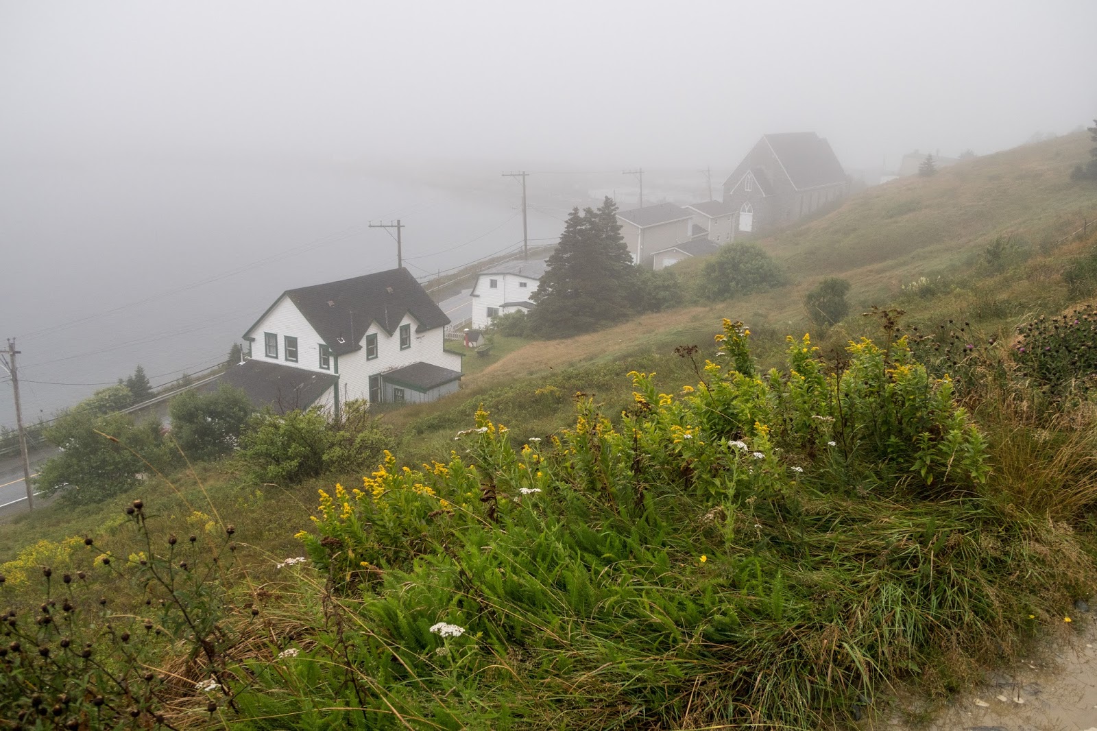
Nearing Ferryland


The highway is actually between the path and the ocean.

The path was up on a ridge primarily on an old road.
The road made for easy hiking, but there were few views today.

The path used actual roads for part of it. It cleared up a little.

There was some hiking through the forest.


I reached a ball field and it was raining quite heavily. I stopped in the dugout to take a break.

Scoggins Head


Lance Cove (I believe)

I descended to the water.


It was a scenic walk through Calvert.

Gut Pond

Visibility improved and I could see across Calvert Bay.


It was evening and I could barely see the sun coming through the clouds for the first time during the day.

As I was nearing the end of the road walk, I saw a couple out walking with their dogs, the first people I had met that were hiking on the ECT. Near the Cape Broyle Head Trailhead there was a nice pond.


In the night a gust of wind blew my tent down and I awoke to a star-filled night.

I could see the lights from Ferryland in the distance across the bay.

Continue to Day 3
Very nice photographies that speak about the trail conditions and the landscape. Merci.
ReplyDeletePierre-Émile