Distance: 26 km (16.16 miles). Cumulative: 172.35 km
Paths: Mickeleens (2.8/7.3), Spout (16.3), Motion (2.0/13.5)
Community: Bay Bulls (4.9)
It started to rain as I packed up camp.


I looked down from Island Meadow and remembered going around the island on the boat tour a few days before.
Island Meadow


End of Mickeleens Path

I noticed the Ernest Shackleton in Bay Bulls Harbour.


After crossing a river, I turned left before reaching the church to go to the grocery store to resupply. The store had almost everything needed for a full resupply, but I just bought a little as I planned to stop in St. Johns as well. I took some time to charge my phone at a power outlet outside.

Bay Bulls

On the road walk I passed where we had taken our boat tour from, Captain Waynes.

Next, I began one of the best stretches of wild trail. In fact, it is the longest continuous stretch on the ECT without a community for greater than 30 km.


There was nice coastal scenery on the way to Bay Bulls Light.


Looking across Bay Bulls Harbour.


Bay Bulls Light


Another hiker had just come down from the light, and we talked for a little while.

I climbed to the top.

View south from Bay Bulls Light


One of the windows was broken. There was also a solar panel to keep the light working.

I continued on the Spout Path.


Looking back to the light

There were some impressive coves on the way.


I could still barely see the lighthouse in the distance.


Steep cliffs along the Spout Path


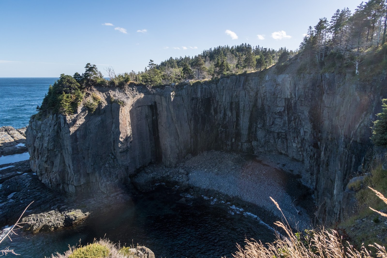
One cove almost had a sea stack formed.

I passed a group of hikers who wanted to know how much farther they had to go.


One of the most impressive sea stacks on the entire ECT came into view.


A waterfall poured off a cliff edge.


A very tall sea stack!


More waterfalls!

At the Little Bald Head Campsite I followed a side trail up a hill to a view point of the spout.


The spout is a coastal geyser, a sea-driven freshwater geyser. It goes off frequently.

There was even a bow that I called a "spout bow" in the mist.


Depending on the angle, the spout bow could stretch across the entire ocean!

The Spout

Spout River

Spout River and the Spout


Continuing on the path, there was lots of remote scenery.


I could still see the Spout in the distance.


I could see to the Motion Path and the Tolt.


There was a bridge over Queens River.


I reached the end of the Spout Path at Shoal Bay Road. I decided to continue a short distance on the Motion path and set up camp at the Miner Point Campsite.


There was a waterfall through the trees.
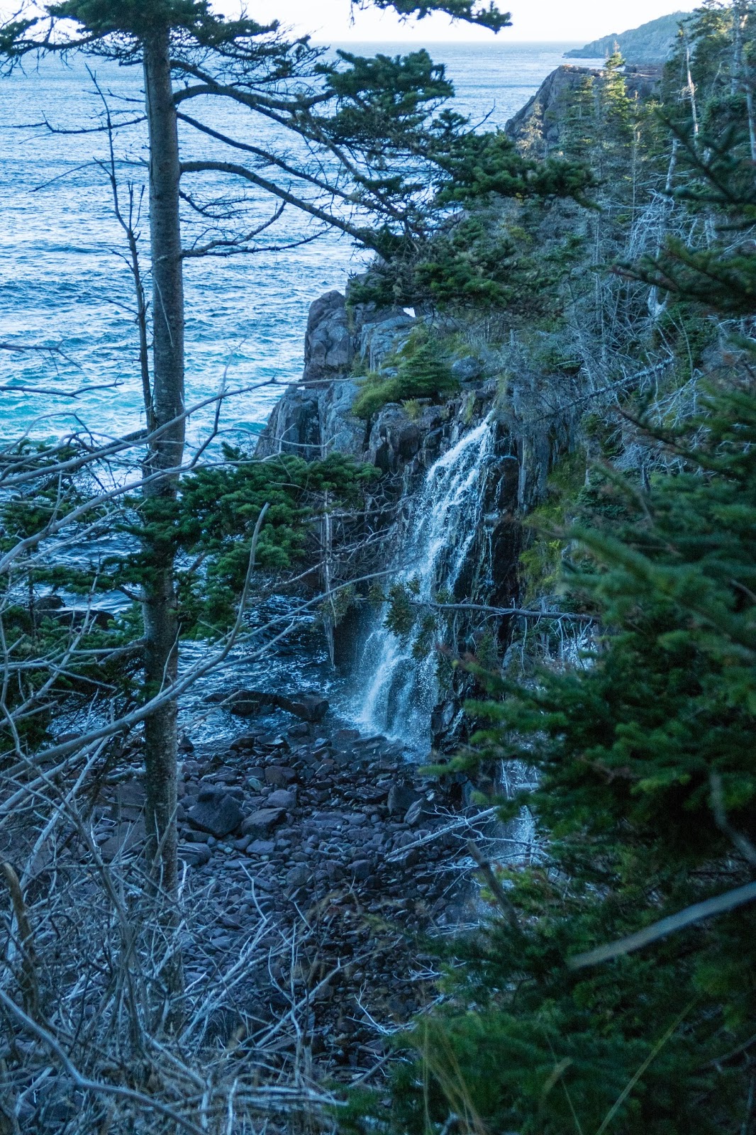
Actually two waterfalls!


It was a pleasant evening with the evening light on the giant cliffs.


Miner Point

The nearby mine is the oldest mining site in Newfoundland.

I arrived at the Miner Point Campsite and found a couple and father/son who were staying for the night. I found a nice place to camp. The couple was heading southbound as far as they could and said the trail had been beautiful. The father and son were out for an overnighter.

I wandered down to the water for some evening photos.

I took a long exposure and the waves looked like they were floating on the rocks.

No comments:
Post a Comment